http://www.gmap-pedometer.com/?r=1285425
After surviving the 12 mile ride, we once again called upon Google Pedometer to expand the loop and search for a rode bike trail. Rode bike rules out the shaggy to the south of Snaggy and requires us to make the 1.5 mile decent down Snaggy Mtn to 105. This also means at the end of the ride you must make the grueling ascent back to the house. As an option park at the Super 8 and start and end form there!
Summary: This ride will exercise all your gears. Be sure you have your triple chain ring and your breaks are in good shape! This is a loop and delivers equal amount of extreme and scenic ups and awesome downs. Passing behind Ski Mountain and Tweetsie railroad you will surely feel on top of the world. The Blue Ridge parkway offers a special challenge on holiday weekends so this ride is best suited for midweek or an early Sunday morning.
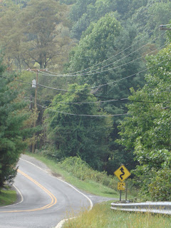
Left out of Snaggy Mtn House, down 1.5 mile to 105, careful on the curves watch out for the occasional car,and loose gravel on the curves.
Right on 105 downhill towards Boone, traffic is not always generous with the road so be sure to maintain your path.
Right on Wilson (second traffic light) towards Boone’s Mall.
Right at light on to Deck Hill Rd.
Left at fork onto Greenway Rd (option is to continue on Deck Hill which will bypass all of the route on 321 and Payne Branch and connect at Flat Top). Kevin says do 321 and Payne Branch.
Right on Meadowview Dr. this is a gradual up hill that takes you behind Wal-Mart and out on to 321.
Right on 321 at the lights and proceed up hill. This is a high speed and heavily traveled road. You are only on this for a 3/4 mile but it seems like much longer!
 Right on Payne Branch with a quick down hill, cross a bridge and then start heading up!
Long steady climb. Do not let the curve fool you, it continues up never levels off. This lasts for about 2 miles.
Left on Flat Top road as Payne Branch continues unpaved straight and Deck Hill intersects from the right. This is the mile 6 mark on the ride. Note that Flat Top road must be named by the hair style of some politician, because it is anything but Flat… even at the top! This is the road that climbs behind Tweetsie (hear the whistle blow) and Ski Mountain. Great views as you look out onto the Smokies. The decent is spectacular as it windes down for miles through rich meadows and pastures until reaching the Blue Ridge Parkway at the 8 mile mark.
Left onto Blue Ridge Parkway South towards Ashville, this is a steady climb for 2.5 miles. You can break this up by stopping at the Craft center located in Moses Cones memorial home which over looks Base Lake and has rocking chairs on the front porch and bathrooms if needed. Nothing to eat or drink though.
Left at sign for 221 and follow signs to Shull’s Mill Road, this may look familiar if you do the 12 mile warm up ride! Climbing this time to the Trail head of Moses Cone, then a long gradual decent through shaded windy roads.
Right Sharply and steep up onto Poplar Grove Rd at the 13 mile mark. Continue a long slow climb, steepest of the ride at this point, cresting when you intersect with Russ Cornett Rd. Continue on Poplar Grove down hill to 105. Long sweeping curves on smooth blacktop.
Right on 105 for a short distance past the Super 8 (did you leave your car here?) We did not !
!
Right on Snaggy Mtn Blvd up a VERY steep climb 1.5 miles to the house! Theresa had to walk part of the first part, but then slowly made the rest of the climb. Kevin even had to stop at the first sharp bend to catch his breath and continue on.
We did this 20 mile loop in 2+ hours (3 hours including picture and rest stops) 9.5 mph average. Next time we start at Super 8.
Maybe even take the road bikes instead of the mountain bikes.
After surviving the 12 mile ride, we once again called upon Google Pedometer to expand the loop and search for a rode bike trail. Rode bike rules out the shaggy to the south of Snaggy and requires us to make the 1.5 mile decent down Snaggy Mtn to 105. This also means at the end of the ride you must make the grueling ascent back to the house. As an option park at the Super 8 and start and end form there!
Summary: This ride will exercise all your gears. Be sure you have your triple chain ring and your breaks are in good shape! This is a loop and delivers equal amount of extreme and scenic ups and awesome downs. Passing behind Ski Mountain and Tweetsie railroad you will surely feel on top of the world. The Blue Ridge parkway offers a special challenge on holiday weekends so this ride is best suited for midweek or an early Sunday morning.
Left out of Snaggy Mtn House, down 1.5 mile to 105, careful on the curves watch out for the occasional car,and loose gravel on the curves.
Right on 105 downhill towards Boone, traffic is not always generous with the road so be sure to maintain your path.
Right on Wilson (second traffic light) towards Boone’s Mall.
Right at light on to Deck Hill Rd.
Left at fork onto Greenway Rd (option is to continue on Deck Hill which will bypass all of the route on 321 and Payne Branch and connect at Flat Top). Kevin says do 321 and Payne Branch.
Right on Meadowview Dr. this is a gradual up hill that takes you behind Wal-Mart and out on to 321.
Right on 321 at the lights and proceed up hill. This is a high speed and heavily traveled road. You are only on this for a 3/4 mile but it seems like much longer!
 Right on Payne Branch with a quick down hill, cross a bridge and then start heading up!
 Long steady climb. Do not let the curve fool you, it continues up never levels off. This lasts for about 2 miles.
Left on Flat Top road as Payne Branch continues unpaved straight and Deck Hill intersects from the right. This is the mile 6 mark on the ride.
 Note that Flat Top road must be named by the hair style of some politician, because it is anything but Flat… even at the top! This is the road that climbs behind Tweetsie (hear the whistle blow) and Ski Mountain. Great views as you look out onto the Smokies. The decent is spectacular as it windes down for miles through rich meadows and pastures until reaching the Blue Ridge Parkway at the 8 mile mark.
 Left onto Blue Ridge Parkway South towards Ashville, this is a steady climb for 2.5 miles. You can break this up by stopping at the Craft center located in Moses Cones memorial home which over looks Base Lake and has rocking chairs on the front porch and bathrooms if needed. Nothing to eat or drink though.
Left at sign for 221 and follow signs to Shull’s Mill Road, this may look familiar if you do the 12 mile warm up ride! Climbing this time to the Trail head of Moses Cone, then a long gradual decent through shaded windy roads.
Right Sharply and steep up onto Poplar Grove Rd at the 13 mile mark. Continue a long slow climb, steepest of the ride at this point, cresting when you intersect with Russ Cornett Rd. Continue on Poplar Grove down hill to 105. Long sweeping curves on smooth blacktop.
Right on 105 for a short distance past the Super 8 (did you leave your car here?) We did not
! Right on Snaggy Mtn Blvd up a VERY steep climb 1.5 miles to the house! Theresa had to walk part of the first part, but then slowly made the rest of the climb. Kevin even had to stop at the first sharp bend to catch his breath and continue on.
We did this 20 mile loop in 2+ hours (3 hours including picture and rest stops) 9.5 mph average. Next time we start at Super 8.
Maybe even take the road bikes instead of the mountain bikes.

No comments:
Post a Comment